Featured Story

Mangroves move inland as seas rise

Adapting to the damaging effects of climate change, plants are gradually moving to where temperatures are cooler, rainfall is greater, f...

Showing posts with label Tropical Storms. Show all posts

11/13/2009

East Coast Flooding from Ida

ATLANTIC CITY, N.J. – Remnants of Tropical Storm Ida pounded the East Coast on Friday, flooding coastal areas in New Jersey after slamming the Carolinas and Virginia.

Strong wind and waves were causing severe beach erosion along the New Jersey shore, but the rain was not as heavy as predicted which could help ease the flooding.

Many streets were under water in Cape May County, which was under a state of emergency. Although officials suggested voluntary evacuations of low-lying areas late Thursday, there was no immediate word of any mandatory evacuations.
read more...

8/27/2009

Tropical Storm Danny May Drench Long Island

Emergency officials are advising Tri-State area residents to prepare for the possibility of heavy rains and flooding as Tropical Storm Danny heads north.

Danny is expected to develop into a hurricane that could threaten Nassau and Suffolk counties on Long Island this weekend along with portions of the Garden State.

Danny is expected to make some waves around the NYC metropolitan area as well.
read more...

8/18/2009

Altantic Hurricane Season Heats Up

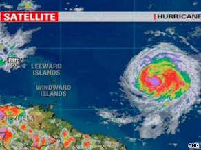
MIAMI, Florida (CNN) -- Hurricane Bill blew toward land early Tuesday, edging closer to the West Indies with near 100 mph winds and the potential for developing into a major hurricane.

Bill intensified and the National Hurricane Center expects it to strengthen over the next 48 hours. Various weather models showed the storm either missing or grazing the west side of Bermuda as it heads toward the U.S. East Coast, CNN meteorologists said Tuesday.

The models showed Bill's path moving dangerously close to the Carolina coast and the Northeast, with the best scenario showing the storm turning back to sea before reaching the United States. Track Hurricane Bill's path across the Atlantic »
Bill is the first hurricane of the 2009 Atlantic season.

The remnants of Tropical Depression Ana continued to move across Hispaniola and Cuba on Tuesday, CNN meteorologists said. Forecasters expect Ana to wash south Florida in heavy rain as it passes through the Keys later this week.

There's a slight chance that Ana could regenerate into a tropical cyclone later this week in the southwestern Gulf of Mexico.
read more...

8/21/2008

Tropical Storm Fay expected to hit Fla. 3rd time

Florida, USA
Image:
This NOAA satellite image taken Thursday, Aug. 21, 2008 at 1:45 a.m. EDT shows Tropical Storm Fay about 35 miles southeast of Daytona Beach Florida. Very heavy rains are continuing along the east coast of central Florida.

PORT ST. LUCIE, Fla.
- Tropical Storm Fay hung offshore Thursday and poured more rain on Florida's central Atlantic coast after flooding hundreds of homes, trapping residents and leaving much of Florida a soggy mess.

Alligators, snakes and other wildlife were spotted in some flooded neighborhoods after high water drove the animals from their normal lairs.

Forecasters expected the storm to continue a zigzag course by hitting the state for a third time in a week, along with Georgia, but didn't think it would strengthen to a hurricane over the Atlantic.


read more...

8/04/2008

Tropical Storm Edouard aims for Texas, La. coast

Breaking Earth News
Gulf of Mexico

Image: Tropical Storm Edouard formed near a major oil and gas producing area of the northern Gulf of Mexico August 3, 2008. (NOAA/Handout/Reuters)

NEW ORLEANS - Tropical Storm Edouard took aim at the coasts of Texas and Louisiana on Monday, threatening to pick up strength from warm Gulf waters and gain near-hurricane speeds over the next 24 hours.

Edouard was expected to make landfall somewhere in Texas or southwest Louisiana on Tuesday morning. It was moving west near 8 mph, and forecasters said the warm waters of the Gulf provided the right conditions for the storm to intensify and approach hurricane strength with winds of 75 mph or more.

A tropical storm warning was in effect from the mouth of the Mississippi River westward to San Luis Pass in Texas. A hurricane watch was in effect from west of Intracoastal City, La. to Port O'Connor, Texas.

Edouard had maximum sustained winds near 50 mph with higher gusts at 8 a.m. EDT Monday. The storm's center was located about 80 miles south-southwest of Grand Isle, La., and 285 miles east-southeast of Galveston, Texas.

read more...

7/21/2008

Texas, Mexico Prepare for Tropical Storm Dolly

Texas, USA

Residents along the Texas-Mexico border kept a watchful eye on Tropical Storm Dolly on Monday, stocking up on plywood, generators and flashlights as forecasters predicted the storm would strengthen into a hurricane later this week and make landfall.

The storm was expected to bring high winds and dump 10 to 20 inches of rain in coastal areas near the U.S.-Mexican border. Emergency officials feared major flooding problems and urged coastal residents to prepare.


read more...

7/15/2008

New wave develops as Bertha batters Bermuda

Tropical Storm Bertha will continue to pummel the island nation of Bermuda through today, while another tropical wave is likely to develop over the next couple of days. The island will receive several inches of rain, while large swells and high surf batter the shores.
A tropical wave is located about 1,000 miles east of the southern Windward islands. Satellite imagery shows a counter-clockwise spin near the center of the area of low pressure. The low is likely to develop into a tropical depression in the next couple of days and there is a very good chance the low will eventually develop hurricane strength.
read more...

7/04/2008

Tropical Storm Bertha spins in Atlantic

MIAMI, July 4 (UPI) -- The second named Atlantic tropical storm of the 2008 season, Bertha, was slowly gathering strength Friday west of the Cape Verde Islands.

The U.S. National Hurricane Center in Miami said at 4 a.m., Bertha was 315 miles west-southwest of the Cape Verde Islands moving toward the west-northwest near 14 mph.

The storm had sustained winds of about 45 mph with higher gusts, and forecasters said an increase in both wind speed and forward motion was likely in the next two days.

To become a Category 1 hurricane, sustained wind speeds must exceed 74 mph.

Meteorologist Dr. Jeff Masters said Thursday's formation of Bertha at 25 degrees west longitude is the farthest east a tropical storm has ever formed in the Atlantic Ocean so early in the season since satellite tracking was established in 1967.

The first named storm this year, Arthur, formed near Belize the day before the season officially started June 1 and drenched the Yucatan Peninsula with rain.

read more...

6/26/2008

Storm and rain lash South China


Hong Kong, China

Tropical storm Fengshen brought more rain and misery to southern China on Wednesday, throwing life out of gear in the economic hubs of Hong Kong and Shenzhen.

Fengshen, downgraded from a typhoon after killing hundreds of people in the Philippines, hit Shenzhen, Guangdong province, early Wednesday morning.

But before that it struck Hong Kong, uprooting trees, pulling down bamboo scaffoldings and causing a heavy downpour.

The storm caused rainfall in many parts of southern and some parts of eastern China. Though it hit Jiangxi province too, Guangdong bore the brunt of its assault.

read more...

6/06/2008

The First Costa Rica Born Tropical Storm

Costa Rica, C.A.
Image:
Communities of Perez Zeledon are Just Now Regaining Road Access After Alma.

Alma deemed THE FIRST COSTA RICA-BORN TROPICAL STORM -
The effects of tropical storm Alma, the first of the season, are still being felt in the southern zone of Costa Rica where a RECORD AMOUNT OF DESTRUCTION occurred along the Interamerican Highway and many families are still without shelter after watching their properties get washed away in the floods. The storm provoked at least 34 landslides that obstructed or destroyed large segments of road trapping some 1,500 people for two days and cutting off the south of the country and access to Panama. Alma, which is the first tropical depression ever to be born in Costa Rican territory, is said to have caused more damage than hurricanes in the past, including Hurricane Cesar that passed through in 1996 destroying sectors of the same road. In the past, hurricanes have affected the country indirectly because they were relatively close, but never before was a storm ever born in their waters. Low pressure and a heavy accumulation of clouds, with rain and lightning that somehow set off differently than was expected and high ocean temperatures helped in the formation of the storm. When the cloud formation hit the warm water, the speed of the wind increased dramatically, giving birth to what was categorized a tropical depression, soon becoming a tropical storm. This took place some 50 kms away from the coast of Guanacaste, SOMETHING NEVER EVER SEEN BEFORE! This occurred this year because of the rainy activity along the Pacific coast, which usually occurs in the Caribbean. Meteorologists pointed out that this had occurred previously in Mexico, but that never before had this phenomenon occurred in their waters. The IMN reckons that during this period, they received between 50 and 80 millimeters more water than usual in some regions of the country, and this is going to surpass the average rainfall that they get normally during this season in these sectors. In the mountains, the precipitation could easily reach 100 millimeters, and winds in the northern and central Pacific can be expected to reach 70 kms per hour. The rain that continues to fall in the region is making it hard for workers to begin the process of rebuilding some of the sectors of road that washed away.

Related News
'Surprise' Tropical Storm Arthur caused damage in Belize. The storm formed suddenly in the Caribbean and swept across Central America on June 1-2, following on the heels of Tropical Storm Alma and catching Belize's 300,000 residents by surprise. Heavy rains and strong winds have caused flash flooding that claimed at least four lives in Belize, although officials have not confirmed the death toll. Thousands have been driven from their homes by rising waters. Roads and bridges have been severely damaged, leaving parts of the country inaccessible. The storm also wiped out papaya plantations, shrimp farms, and the rice crops, devastating the nation's economy and food supply.
read more...

5/21/2008

Death Toll Mounts From Tropical Storm Halong

Philippines
Manila - The death toll in a storm that battered the Philippines over the weekend has risen to 24 with nearly half a million people displaced, the Office of Civil Defence said Tuesday.

Storm Halong blew out of the Philippines overnight and headed towards Okinawa, Japan after causing landslides and flashfloods in northern and central provinces, the weather bureau said.

More than 416,000 people were displaced by Halong in at least five northern and central provinces, the Office of Civil Defence said.


Image: A farmer shows the almost-ready for harvest rice plants which he uprooted from his rice field which was flooded due to storm Halong Sunday May 18, 2008 in San Fabian, Pangasinan in northern Philippines. Tropical storm Halong sliced through the mountainous northern Philippines, blowing roofs off houses and toppling power poles, officials said Monday. (AP Photo)

More Images
read more...

2/19/2008

Tropical storm batters Madagascar

Madagascar
At least two people died and hundreds were left homeless in Madagascar, as Cyclone Ivan brought chaos. The cyclone hit the north-east coast on Sunday with winds of around 200 kph, bringing with it torrential rain. The cyclone knocked out mobile phone and radio networks. The unexpected communications blackout means the fate of nine people, reportedly trapped in a collapsed hotel on Sainte Marie, remains uncertain. The authorities say every area that the cyclone has passed through is now experiencing flooding. Roads into the worst affected areas have been washed away. The storm is now moving down the west coast of Madagascar and heading for Mozambique on the African mainland.
read more...

12/13/2007

Flooding from Tropical Storm Olga kills at least 14 in region

Breaking Storm News
Caribbean

"We have an emergency situation. It's a catastrophe,'' Gov. Jose Izquierdo said.


SANTO DOMINGO, Dominican Republic - Tropical Storm Olga triggered floods and landslides on the Caribbean island of Hispaniola Wednesday, killing at least 13 people and forcing thousands to flee their homes, authorities said. One person also died in Puerto Rico.

Hardest hit was the northern province of Santiago in the Dominican Republic, where heavy rains forced authorities to release water from a near-capacity dam into the already swollen Yaque river. The provincial governor said at least seven towns were completely flooded.

People complained on local radio that they were not warned of the water release from the dam, and officials acknowledged it might have caused some of the 10 deaths reported in the province.

Video: Olga's latest trajectory

Related Video
read more...

12/12/2007

Late season storm likely to bring heavy rains today

Sub-Tropical Storm Olga near Puerto Rico (Credit: NOAA)

BREAKING STORM NEWS

CARIBBEAN
JAMAICA is likely to be affected today by heavy rains from Tropical Storm Olga, which yesterday drenched Puerto Rico, while the Dominican Republic was forced to reopen hurricane shelters more than a week after the official end of the hurricane season. "Periods of heavy rainfall and gusty winds, along with above-normal waves along the north coast are likely Wednesday afternoon, decreasing on Thursday."

Subtropical Storm Olga
moved over the Dominican Republic late Tuesday after blasting the northern coast of Puerto Rico, causing flashfloods and mudslides. The storm's reach extends out as far as 240 miles to the northeast and northwest of the center, with winds blowing as much as 40 miles an hour. "It's UNUSUAL to have a storm this late in the season. However, the conditions aren't ideal for the storm to strengthen any further, and it should dissipate in the next few days."
read more...

11/05/2007

Intense Atlantic storm causes widespread outages

Canada
Tens of thousands of people in Atlantic Canada and parts of Quebec remained without power late Sunday after the remnants of Hurricane Noel battered Atlantic Canada with high winds and driving rain.
In Nova Scotia, which was hit hardest, as many as 170,000 homes and businesses lost electricity overnight.


RELATED NEWS
Image: Tracking Noel
FLORIDA - A portion of A1A remained closed Sunday, after Noel sent ankle-deep water onto the beachside road. The deluge that prompted authorities to shut down A1A Saturday had receded a bit, but the waters surged again at high tide Sunday afternoon. High tide was expected between 4 and 4:30 p.m. to most likely cause more flooding before the Noel swell of high winds and water passed. Strong rip currents and high surf winds are also expected to hit beaches along Miami-Dade, Broward and Palm Beach counties, which remain under a coastal flood advisory. Besides the A1A flooding, a surge of 4-foot waves also flooded a Sunny Isles Beach hotel garage. Weather experts said ocean swells whipped up by the departing tropical storm are what turned parts of State Road A1A into an extension of Fort Lauderdale beach Saturday as high tides swept up and dumped sand and water onto the roadway. Disaster might be the word used by those tracking the extensive beach erosion that many South Florida beaches have experienced in the past few weeks, including from Noel, which scraped away huge amounts of sand, especially in Palm Beach County. High winds have generated battering waves that have gobbled away shoreline, shrinking beaches. Beach conditions over the past week or so have made some residents re-think how devastating the storm surge could be if the area is hit head-on by a hurricane. "It's looking like if we get another storm, there's not going to be any beach left." Noel sent a swell of high winds and water straight at South Florida as it passed to the northeast. As it continues to move away from South Florida, conditions here should improve. The worst should be over, at least in the near term.
read more...

11/01/2007

Update: Caribbean deaths mount in wake of Tropical Storm Noel

Breaking Earth News
Image:
Satellite photo of Tropical Storm Noel, 31 Oct 2007
Tropical Storm Noel strengthened after drenching Cuba and killing at least 61 people with surging floodwaters in the Dominican Republic and Haiti. The death toll from days of downpours in the Dominican Republic, in particular, has begun to climb as emergency workers fanned out to bring aid to towns and villages cut off by raging rivers and inundated by chest-high floods. Forty-one people were confirmed dead and another 33 were missing while at least 25,540 people were homeless and 6,300 homes had been destroyed. Several bridges had collapsed and mudslides blocked roads and at least 39 communities were cut off by floods.

In Haiti at least 20 people died. Around 400 houses have been destroyed.
In Cuba, thousands of people were evacuated from vulnerable areas but no casualties were reported as the country has one of the most effective civil protection operations in the region. The storm dumped 150mm of rain in just six hours over Baracoa in Cuba, causing floods and cutting off roads at the already water-logged eastern tip of the island. "We are getting a constant downpour and strong gusts of wind. The sea is very rough."

In Jamaica, one person died when a house collapsed in the heavy rain.
Torrential rain was also falling over parts of the Bahamas.

Strong winds sent waves crashing onto southeast Florida's Atlantic beaches and rain whipping down the streets of Miami.
read more...

10/31/2007

Tropical Storm Noel Nears Florida

Breaking Storm News
Florida, USA
Image:
This NOAA satellite image taken Tuesday, October 30, 2007 at 01:45 PM EDT shows Noel near Camaguey, Cuba, which is producing widespread rainfall across southeastern Cuba, southern Bahamas, Hispaniola and Puerto Rico. Farther north, a stationary front cuts across the Florida Peninsula. (AP PHOTO/WEATHER UNDERGROUND)

MIAMI (AP) — Residents of southeastern Florida were advised early Wednesday to keep an eye on the progress of Tropical Storm Noel, a killer storm which could pass close to the state over the next few days.

At 5 a.m. EDT, Noel's top sustained winds were near 40 mph, down from 60 mph a day earlier, according to the National Hurricane Center. The storm has crashed through the Caribbean, creating floods and mudslides that have killed at least 22 people.

It was moving "erratically" toward the north-northwestward near 7 mph and approaching the northern coast of Cuba, the center said. But it was expected to turn away from Florida later in the week and speed into the open Atlantic.

Tropical storm-strength winds extended up to 175 miles from the storm's center. Above-normal tides and heavy rains were expected in its path into the Atlantic.


RELATED VIDEO AND NEWS


read more...

10/30/2007

Update: Caribbean storm kills 20 people

BREAKING EARTH NEWS
Dominican Republic

At least 20 people have been killed in flooding in the Dominican Republic following torrential rains dumped by Tropical Storm Noel.

Most of the deaths were reported along the south coast, east of the capital Santo Domingo.

It is feared the death toll will rise, with another 20 reported missing.

The storm was continuing to drop heavy rain on the country and on neighbouring Haiti, as it travelled towards Cuba and the Bahamas.

By 0900 GMT, Noel's centre was very near the town of Gibara on the north coast of Cuba and some 270 miles (435km) south-east of Nassau in the Bahamas.

The National Hurricane Center in Miami warned that the storm was expected to strengthen and bring heavy rain to south-eastern Cuba and central and south-eastern Bahamas.

Power cuts

At least 10in (25cm) of rain has already fallen on the island of Hispaniola - divided between the Dominican Republic and Haiti - and the rain is continuing to fall there, forcing river levels higher.

read more...

10/29/2007

Tropical Storm Noel Rains Lash Haiti

Breaking Storm News
Haiti

Image:
A man takes photos of the waves and clouds produced by tropical storm Noel at the seafront of Santo Domingo, Dominican Republic Sunday, Oct. 28, 2007. (Ramon Espinosa/AP Photo)

Tropical Storm Noel lashed Haiti with heavy rains early Monday as it moved across the impoverished Caribbean nation, generating fears of flash flooding on deforested hills often blanketed by rows of flimsy shacks.

Noel, the 14th named storm of the Atlantic season, was expected to drop as much as 20 inches of rain on Haiti and the Dominican Republic which share the island of Hispaniola before heading on a path east of Cuba toward the Bahamas.

read more...

9/21/2007

Tropical Storm Warnings Issued For Gulf Coast

Breaking Storm News
Gulf of Mexico
Tropical storm warnings were issued for parts of the U.S. Gulf Coast on Thursday as hurricane forecasters said a low-pressure system that cross the Florida peninsula on Thursday developed into a subtropical depression in the eastern Gulf of Mexico.

The tropical storm warning extends from Apalachicola west to the mouth of the Mississippi River, including New Orleans.The system could intensify into Tropical Storm Jerry before impacting the central Gulf Coast late Friday or early Saturday.A band of severe weather spinning off this systems prompted tornado watches and warnings Thursday night and Friday morning.

Projected Path of Storm

Just before midnight, a tornado damaged up to 50 home in the Central Florida town of Eustis.Flooding rains and some downed trees caused problems before dawn across northeast Florida and southeast Georgia. Winds knocked out power to thousands of homes overnight and the Florida Highway Patrol said a tractor-trailer heading north on Interstate 95 toward Jacksonville about 3:45 a.m. Friday was blown over by a gust of wind.

RELATED NEWS
Photo:
A tornado with winds up to 105 mph destroyed 20 homes and seriously damaged 30 more in Eustis, Fla. (WKMG/Local6.com)

Florida Tornado Strike 50 Homes
(CBS/AP) Severe weather, including a confirmed tornado, damaged about 50 homes in central Florida before the system became a subtropical depression Friday and had parts of the Gulf Coast under tropical storm warnings.

The EF-1 tornado struck Eustis with maximum winds estimated near 105 mph.


HURRICANE WATCH
Satellite Image:
(NOAA)

Baja, California on Guard for Hurricane Ivo
(CBS/AP) Hurricane experts say Ivo's path is hard to predict - some indicators suggest it could dissipate while still at sea - others suggest it could hit Baja California as soon as Sunday.

Hurricane Ivo picked up some speed late Thursday as it curved toward Mexico's Pacific coast on path that could take it near Baja Califorina's resorts over the weekend.
read more...

 
Copyright © 2018 Great Red Comet-Earth Science Chronicles • All Rights Reserved.
Template Design by BTDesigner • Powered by Blogger
back to top